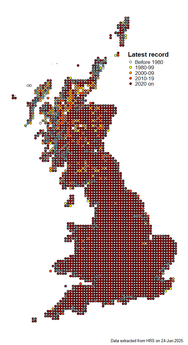
Coverage
Map showing the latest year at which a record was received from each hectad (10 x 10km square of the Ordnance Survey National Grid).
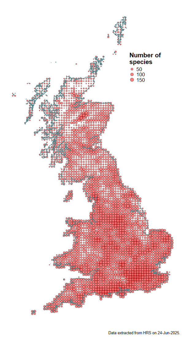
Number of species
Number of species recorded per hectad (at all times).
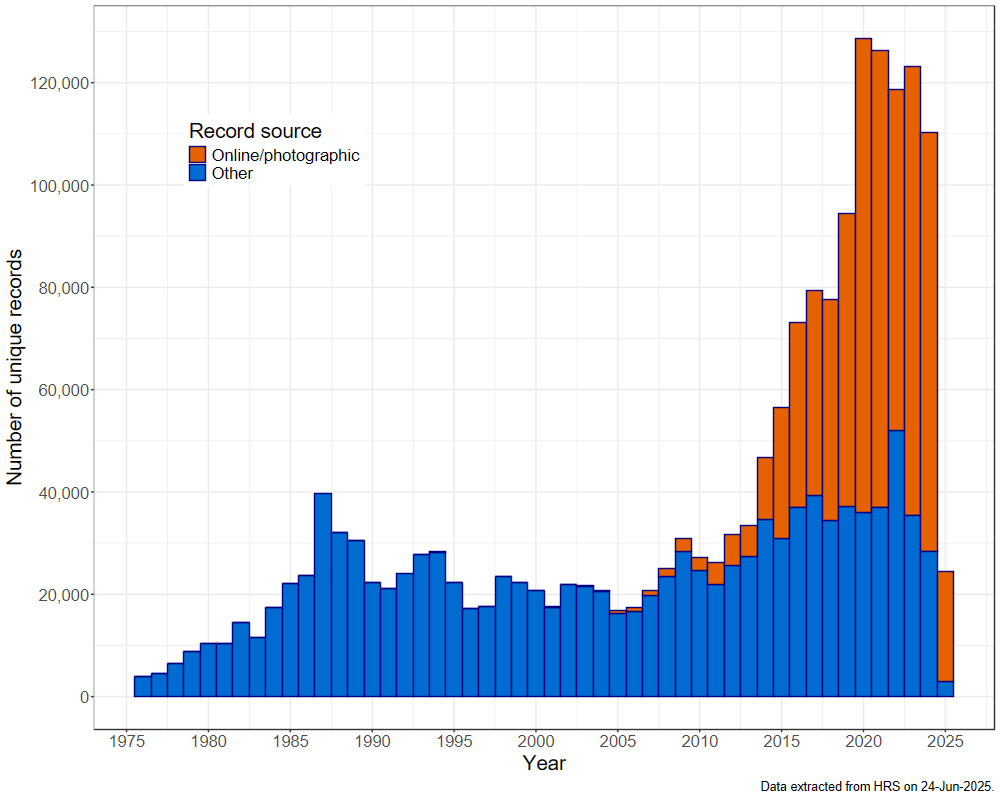
Number of records per year
Number of unique records received each year since the Hoverfly Recording Scheme was initiated in 1976. In this context a unique record is defined as a unique combination of species name, date, grid reference of the location from where it was recorded and the recorder's name. Records are categorised into those received via online postings (mostly of photographs) and others.